Showing posts with label Hike. Show all posts

Thursday, August 18, 2016

Experience - Low Tide at the Homer Ferry Dock and the Lee Shore of the Spit

Sea stars under the ferry dock

Summary

Low tide is one of my favorite times to visit the beach and the area around the base of the ferry dock is one of my favorite places.  Although I also really enjoy Bishop’s Beach and Mariner Park.  At low tide, you can get a glimpse of sea life you would

Tuesday, August 16, 2016

Saturday, August 13, 2016

Hiking - Hidden Creek Trail


Hidden Creek


Stats

Distance:  2.6 miles                     Difficulty: Easy to Moderate                            Time:  2 hrs

Summary

The best part of the Hidden Creek Trail is when it meets up with the marshlands

Thursday, August 11, 2016

Hiking - Cottonwood Trail

View From the Cottonwood Trail


Stats

Distance:  0.25 miles                        Difficulty: Easy                                 Time:  20 minutes

Summary

The Cottonwood Trail is a short hike to a fabulous view of the Grewingk Glacier, Homer Spit and the Kachemak Bay.

Wednesday, August 10, 2016

Hiking - Ben Walter's Park Floating Dock


View from Ben Walter's Park as a Floatplane Lands
Stats

Distance:  0.1 miles         Difficulty: Easy           Time:  15 min

Summary

Tucked away at the side of Beluga Lake in Homer, Alaska, Ben Walter’s Park is

Saturday, July 9, 2016

Hiking - Winner Creek Trail (updated summer 2016)

Dappled Light in a Temperate Rainforest


Stats

Distance:  5.5 miles (round trip)                       Difficulty: Easy                           Time:  Full-day

Summary
Blueberries
The winner creek trail is one of the best kept trails we’ve ever found in Alaska.  It’s also one of the prettiest

Monday, August 4, 2014

Experience - Flowers of Alaska

Fields of Fireweed


As we wander into the Alaskan wilderness (or even just around our back yard) we see flowers everywhere.  Many are small and hard to spot.  This post is a collection of photos of the wildflowers we have found

Friday, July 11, 2014

Hiking - Watermelon Trail (the 1.5 hr version)

Seeping vistas from Watermelon Trail

Stats

Distance:  14.3 miles (one way)                       Difficulty: Easy-Moderate

Summary
Watermelon trail was recommended to us by some friends.  So on a beautiful day in early July we decided to try out the trail.  Watermelon trail is really an ATV trail (which is why it's so long), but we were the only ones on the trail the day we hiked it.


Opinion

This trail has some great views.  This hike will probably be amazing

Friday, June 13, 2014

Hiking - Skilak Lookout Trail

View from the top of the trail


Stats

Distance:  4 miles                              Difficulty: Moderate                                     Time:  4 hrs

Summary

The Skilak Lookout Trail ends at a truly spectacular view of the mountains and Skilak lake.  Best of all, it has beautiful views all along the trail and, at least in June, there were wildflowers everywhere.  The hike itself wasn't too bad most of the time.  We considered it moderate because of occasional steep spots and muddy patches.  It also has a steady low incline to the top of the mountain for a total elevation change of 790 feet.

Opinion

This is is very pleasant hike with truly spectacular views.  The high angle view of Skilak Lake is beautiful; Skilak Lake has that beautiful milky blue color unique to glacier lakes.  In addition, there was a wide variety of spring flowers all along the trail.


Trail Advice

Sweat resistant mosquito repellent is a must.  The bugs were out in force.

If the temperature is acceptable before you start, a jacket is probably not necessary.  You will produce enough heat on the trail to keep you warm.  

In the spring (June in Alaska) the trail can be muddy in spots.  Wear hiking shoes you don't mind getting muddy.


Suitability

This trail is suitable for adults and children.  But the trail is a total of 4 miles with some climbing so be sure you and your kids are up for it.


Trailhead


Trailhead from the road

Warnings
To find the Skilak Lookout Trail take Skilak Lake Rd from the Sterling Hwy.  Skilak Lake Rd is a loop of sorts that starts and ends at Sterling Hwy.  There is an East entrance just outside Cooper Landing and a West entrance a few miles outside Sterling.  You can take either entrance.  The trailhead is a mile 5.4 on Skilak Lake Rd.  The parking area is on the north side of the road and the trail is on the south side.  It is well labeled.


The Hike

This trail is one of many in the Kenai National Wildlife Refuge.  The maps for these trails can be found on the Kenai Refuge Map website.  We chose this trail because the 2014 Funny River Wildfire was still burning and we wanted to see of we could see the fire or fire damage from the overlook.  


Boardwalk near the trailhead
The trail starts through a dense spruce forest along side a creak, but quickly opens into meadows filled with alpine wildflowers.  Many of the trails in this section of the Kenai National Wildlife Refuge are in an area that burned in 1996 and this is one of those trails.  At first it can be difficult to tell the area burned, but then you realize the large open meadows along the trail were once spruce forest.  The area is quickly being reclaimed by birch, cottonwood, and alder.  In a few more years the trees will be tall enough to overtake the meadows and the character of the walk will change again.  


Early view of Skilak Lake
You can also still see some dead, burned standing trees and more fallen spruce can be seen on either side of the trail.  The fallen trees have opened up the view and as a result you get frequent terrific views of Skilak Lake and the surrounding mountains.  


Eidelweiss
June is early spring on the Kenai Peninsula and the trail was lined with a huge variety of wildflowers.  Most common on the lower trail was Edelweiss, but there was also Lupine, wild Rose, wild Geranium and many more.  The flowers made the trail a delight to walk.
Wild Rose

The trail is pretty much a shallow constant grade with occasional steep spots and some muddy area.  The steep spots all have good switchbacks making the trail easy to walk most of the time.  We listed it as moderate because of the few steep areas and the muddy patches.  This trail has been hiked a lot and, as a result, the trail has sunk 2 or 3 inches into the peat that makes up the soil of the area and is rather narrow, so the footing can be tricky sometimes.


A view from the top
When you get to the top the view makes this hike very much worth it.  There is a 270 degree of the Wildlife Refuge.  Interestingly, there was no view of either the Funny River fire or the areas it had burned.  The good news is the way down is just a beautiful as the way up and is easier going.
Another view from the top

Hiking - Bishop's Beach at a Very Low Tide

Low tide at Bishop's Beach

Stats

Distance:  Up to you                             Difficulty: Easy                                   Time:  Up to you

Summary

Bishop's Beach is probably the best known beach in Homer.  This beach is popular for dog walking, clamming, and driving.  On an unusually beautiful Saturday in May the low tide was lower than -3 ft.  We decided to hike on the beach to see if we could find sea stars.


Opinion

At high tide Bishop's Beach is a fairly ordinary beach, but at low tide it becomes something special.

Sunday, June 1, 2014

Hiking - Kenai National Wildlife Refuge Ranger Station

Boardwalk across the marsh


Stats

Distance:  0.25 miles                            Difficulty: Easy                                    Time:  15 min

Summary

We stopped at the Kenai National Wildlife Refuge ranger station, located on Ski Hill Rd in Soldatna to see if they had hiking maps or other useful information about the hiking in the Kenai National Wildlife Refuge.  The refuge is enormous, covering most of the northern Kenai Peninsula, but only a relatively small part actually has maintained trails.  The ranger station has a variety of activities for children and adults, but there are only 3 short trails at this location.

Opinion

If you are looking for information on parts of this refuge we haven't covered yet, stop here!  The people at this ranger station were a wealth of information!  They helped us find a variety of short hikes ranging from a few hours to a day.  Moreover, when we expressed and interest in kayaking, they pointed out the best lakes for kayaking contained within the refuge.  They also warned us off of a few; apparently they suffer from high winds and wind driven waves as high as 4 feet or more.

The trails near this ranger station are pleasant and wind through the spruce and cottonwood forest.  We took the shortest, a quarter-mile trail to the lake, because were were short on time that day.


Trail Advice

This trail has the usual voracious mosquitoes during summer and has little shade.  We strongly recommend a good coating of both sunscreen and mosquito repellent.


Suitability

The trails around the Visitors Center is suitable for all ages, but not wheelchairs.  These trails are often used for children's educational programs.


Trailhead

To find the ranger station:

  • From Homer:  Take Sterling Hwy north.  Turn right on Ski Hill Rd (across from Sky View High School).  Follow the gravel road about a mile and watch for the signs for the Visitors Center.  The turn will be to the right.
  • From the north:  Just before you exit Soldatna, turn left on Funny River Rd.  Turn right about one block later onto Ski Hill Rd.  Follow the gravel road about 1 mile and watch for the signs for the Visitors Center.  The turn will be on the left.


The Visitor Center

We were in Soldatna shopping for things we can't get in Homer.  Were weren't in the mood to hike (too busy), but we'd been passing a National Refuge sign for months and were curious.  So, that day, we decided to drive the road and see what we found.  What we found was a visitor center with very helpful rangers and support staff.

After a quick look around their displays we struck up a conversation with a ranger and the lady manning the information desk.  We asked them about the day hike trails in the refuge.  We got lots of suggestions and you will be seeing posts about them over the next few weeks.  At the time we visited, spring was just beginning and the hikes would have been barren and brown.  Now the Kenai has exploded with life and we are just waiting for good weather to start hiking the recommended trails.

We also asked about kayaking.  They warned us away from Skilak Lake and Tustamena Lake.  Although they look very promising, it turns out they are not safe for small craft (even motorized ones).  When the wind picks up--and it does virtually every day--waves on the lake can get over 4 ft in height.  They also advised against Engineer Lake.  It isn't as dangerous as the other two, but suffers from high wind and waves as well.

The Hike
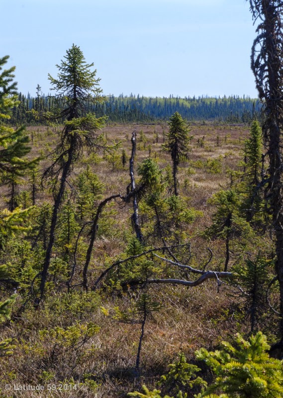
Marshland
After we finished chatting with the rangers, we decided to walk the shortest of the trails to stretch our legs.  The hike is very short and pleasant.  It winds down a hill to the lake behind the ranger station.  Most of the trail is through a spruce forest rich with spruce, cottonwood, birch, moss, and lichen.  At the end it lets out on a marsh where a boardwalk takes you to the lake.  

I wouldn't go out of my way to do this hike, but if I were stopping at the Visitors Center for information, I would definitely take a break from driving on this trail.


The Funny River Fire


Smoke heading south on
Sterling Highway

Smoke from the Funny River fire
People considering hiking in the Kenai National Wildlife Refuge might be concerned about the effects of the Funny River Fire.  We've crosschecked the maps against the fire and, large as it was, the fire was to the south of the trails.  In fact, most of the area burned was true wilderness.  However, if you are planning to hike in the Cooper Landing region or near this Visitor Center, I would recommend waiting until the fire is fully controlled.

Friday, May 30, 2014

Information - Apps We Use

Several people have asked up how we develop our blog.  One of the most common questions is what apps do we use.  We’re Apple, iPad, and iPhone junkies so we’re working through the iTunes App store. 

And mainly we use only two apps.  One for recording the map for the hike which is Motion GPS.  The other is AyeTides (iPad)  or AyeTide XL (iPad) to check the tides for our beach hikes or trying to time our arrival with the Turnagain Arm bore tide or the rush of water at the Homer Spit Fishing hole.  AyeTides also provides the sunrise/sunset times which helps us pick depart times for the best photos. 


We also use a number of weather apps but there is no real front-runner.  The weather in Alaska seems to be hard to forecast and we are constantly cross checking them.  But we’re always prepared on our hikes for inclement weather.

Sunday, May 25, 2014

(Closed due to massive undercutting of trail) Hiking - Diamond Creek Trail to Kachemak Bay Beach

Young Eagle on the Beach
Closed due massive undercutting of the trail
-- We'll update this post when it gets opened again.
-----------------------------------
Stats

Distance:  0.5 miles +           Difficulty: Easy / Moderate           Time:  30 min +


Summary

This hike is in Homer, AK.  The first time we walked this trail was 16 Jun 2013.  It was a beautiful day, so we decided to go for a walk on the beach.  We hiked the trail again a couple of weeks later.  It is close and easy, so we'll be doing this hike often.

The link to the official web site is http://www.cityofhomer-ak.gov/recreation/diamond-creek-trail.  This is limited site that lists a few of the hikes in the Homer area.


Opinion

We love this hike for an easy day hike.  We prefer this hike and beach access to the better-known Bishop Beach.  The beach here is more interesting

Friday, December 27, 2013

Winter Hiking - Spitting in the Winter (Hiking the Homer Spit)

Ice flow on the east side of the Spit


Stats

Distance:  Up to you                       Difficulty: Easy                              Time:  Up to you

Summary

The Spit is a Homer landmark.  It is exactly what its name says, a spit of land reaching into Kachemak Bay.  In summer, the spit is best know for the fishing charters, shopping, and fish packing.  In the winter, the spit belongs to strollers, photographers, and dog walkers.

Opinion

In winter, this is still one of our favorite hikes.  

Sunday, November 24, 2013

Hiking - Portage Glacier Trail (all the way to the beach)


Stats

Distance:  4.7 miles                  Difficulty: Strenuous                                Time:  5 hrs

Summary

We chose to try the Portage Glacier Trail on 10 Jul 2013.  The hike goes up a nearly continuous inclined for a 750 ft elevation change, then back down (more gently) the full 750 ft to reach the portage glacier lake.  We found the hike on the National Park Service map (NPS Portage Glacier Trail).  This page is useful, but someone dated, see The Hike section of this post for updated information.

Opinion

This is a fabulous hike!  But we wouldn’t recommend it to anyone who is not at least reasonably fit.  The highlights of the hike include

Sunday, August 18, 2013

Adventure - Blueberry Picking at the Peterson Research Station


Sunset at Peterson Research Station

Stats

When: Early – Mid August                         Where: Peterson Research Station

Summary

Alaska seems to be the US capitol for berries.  More berries grow in this state than I’ve ever heard of anywhere else.  We’ve got blueberries, raspberries, blackberries, salmon berries, watermelon berries, elderberries, currant, marionberries, cranberries, lingonberries (low bush cranberry), nagoonberries, crow berries, serviceberries, and strawberries.  Most of these grow wild, but several cultivars are grown in home yards and farms as well.  Truly, I didn’t know half these berries existed until I moved here.

On 11 Aug 2013 our neighbors asked if we wanted to take a boat ride across Kachemak Bay to go blueberry picking at the Peterson Research Station.  The Peterson Research Station belongs to the Center for Alaska Coastal Studies based out of Homer.  The station is situated on 5 acres of wild land and coastline and their lower trails go through extensive blueberry fields, with a mix of currant and salmonberry randomly distributed throughout.  The berries are fair game to visitors, although they ask that you leave a few for the bears.

Opinion

This was a blast.  We picked berries for about 2 hours and came home with 7.5 lbs (22.5 cups)

Hiking - Eveline State Recreation Site outside Homer

Portlock and Dixon Glaciers from the Bottom of Alpine Meadows Loop

Stats 
Distance:  1.4 miles                   Difficulty: Easy                                 Time:  50 min

Summary
On 15 Aug 2013 we got a break in the much overdue rain and headed to the Eveline State Recreation Site.  Eveline has trails that are used in both summer and winter.  The summer trails are two loops: Glacier View Loop and Alpine Meadows Loop.  Both trails are inland meadows with excellent views of the Portlock and Dixon Glaciers.  In the winter the trails are tagged for cross-country skiing and snow shoeing; the views might be even better then as the air tends to be more clear in the winter.  The Alaska Department of Resources web site for the recreation area is Eveline State Recreation Site.  Other blogs have trip reports on this site that can be found with an internet search on Eveline State Recreation Site.


Opinion

This is a very nice hike.  We like it a bit better than the lower Homestead Trail; it’s better maintained (less boggy) and has slightly better views although both trails have masses of wonderful wildflower

Monday, August 5, 2013

Experience - Walking Among Lupines

Lupine on Kachemak Bay


Stats

When: June - July                                                                                            Where: All over Alaska

Summary

The Lupine bloom is the first of the big flower blooms in Alaska; although there are other wildflower that bloom before they don't grow in such huge clusters.  Like most flora displays the timing and quality vary from year to year. 

Opinion

While not a spectacular as the Fireweed bloom the Lupine season is quite dramatic and well worth seeing.

Sunday, August 4, 2013

Experience - Walking Among Fireweed


Early Fireweed Bloom on Homestead Trail


Stats

When: Late July - August                                                 Where: Meadows all over Alaska

Summary

The Fireweed bloom is an annual phenomenon in Alaska.  It is usually viewed as the end of summer.  Like most flora displays the timing and quality vary from year to year. 

Opinion

This is a must see experience!

Wednesday, July 31, 2013

Hiking - Walking The Spit Starting at Mariner’s Park


Stats

Distance:  Up to you                       Difficulty: Easy                              Time:  Up to you

Summary

The Spit is a Homer landmark.  It is exactly what its name says, a spit of land reaching into Kachemak Bay.  The spit is best know for the fishing charters, shopping, and fish packing, but is also a popular place for beach strolls and clamming.  We took a hike on the west side of the Spit starting at Mariner’s Park on 9 Jul 2013.

Opinion

This is one of our favorite hikes when we are in the mood for an easy stroll on the beach.  The common sites include Bald Eagles, gulls of several varieties,